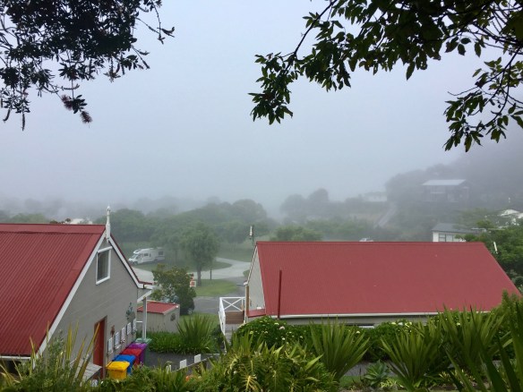
As predicted, the weather had deteriorated by morning, and we were met with fog, grey skies, and rain. As it was Thanksgiving day back home on the other side of the dateline, we made phone calls to family before hitting the road.
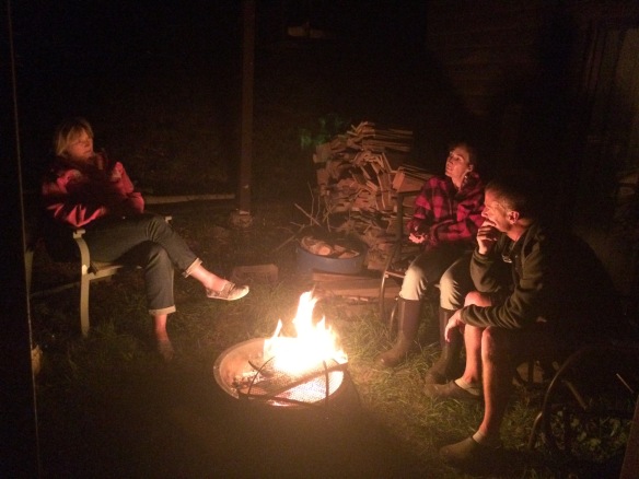
Quite a different view from our campsite!
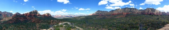
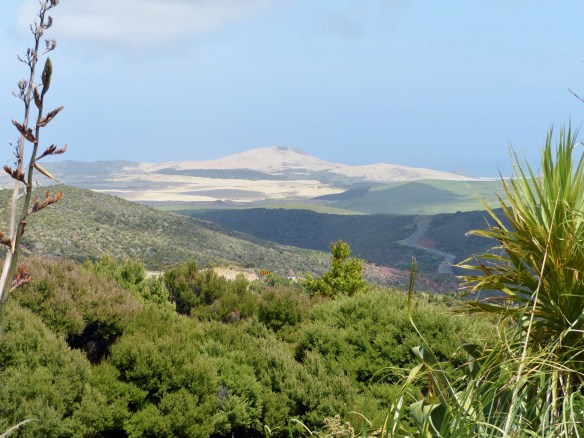
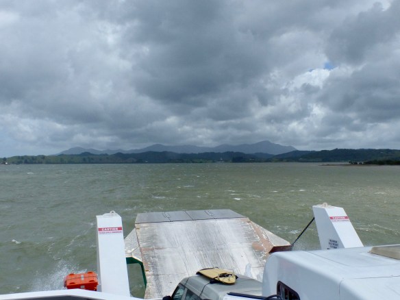
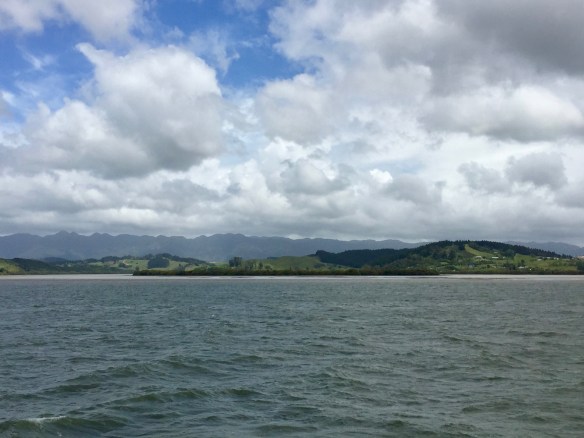
Upon leaving Russell, we took a short car ferry across to Opua and drove through Paihia to the Waitangi Treaty Grounds. This is the most important historic site in New Zealand as it is where the Treaty of Waitangi, New Zealand’s founding document, was signed by the Maori and the British back in 1840. There is a newly refurbished museum, guided tours of the site, and beautiful grounds. I hadn’t actually done much research on it beforehand, which was a mistake on my part, as to visit the Treaty Grounds was a bigger time and money commitment than I had anticipated. Because of this, and the bad weather, we decided not to do the full visit and instead, talked our way into the gift shop for a peek. I would like to visit this site one day, but really, I would want to have a day at leisure to do it justice. I guess I will just have to go back! We needed to get further north that day if we were to make it to Cape Reinga. Consequently, we pushed on and drove through intermittent rain all the way up to Pukenui, which sits about a third of the way up the long peninsula which forms the top of the North Island. As the weather was not cooperating, there didn’t seem to be much point in making a lot of detours to the many beauty spots that I’m sure we passed. Pukenui Holiday Park was small but serviceable and we spent a quiet few hours napping, reading, etc. after we arrived.
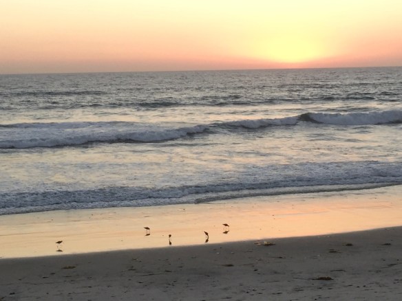
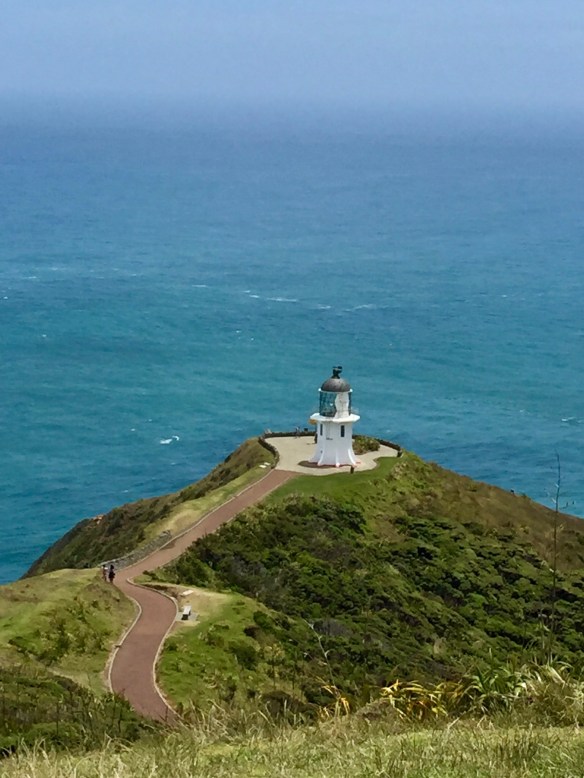
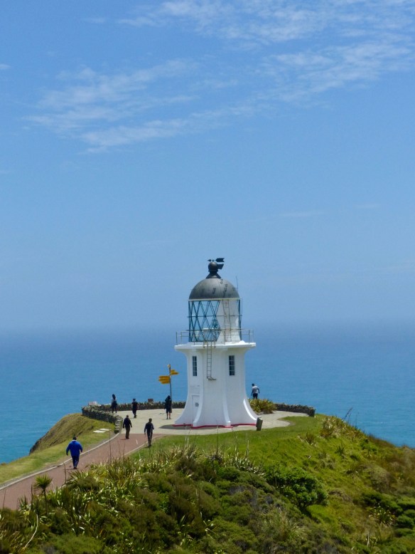
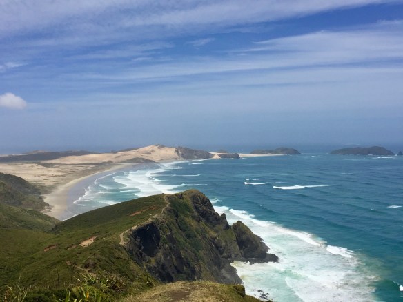
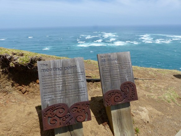
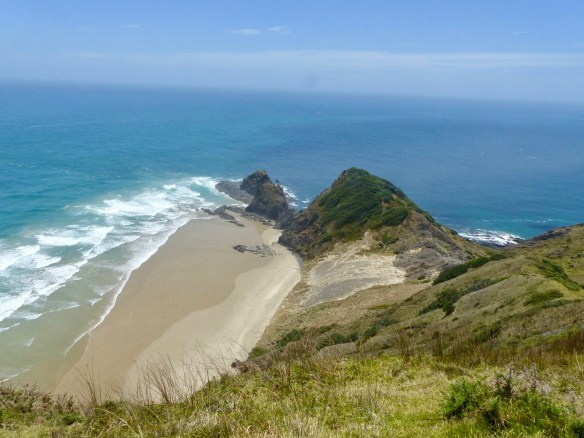
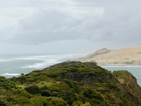
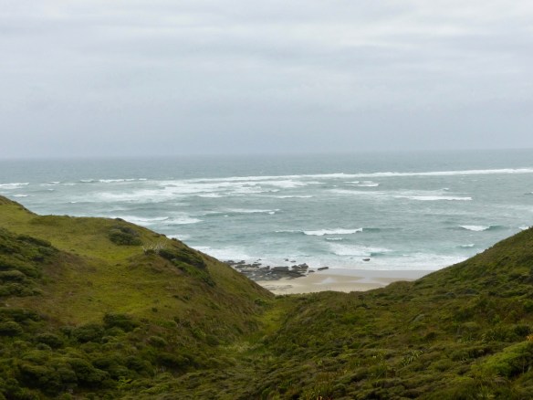
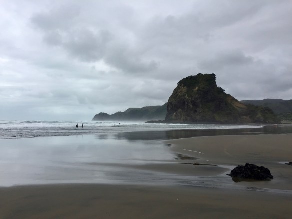
Cape Reinga was our destination the next day. The weather had improved somewhat, leaving it windy with some clouds, but no rain. Cape Reinga is the northernmost point in New Zealand and holds a significant place in Maori tradition as the jumping off point of souls heading back to their homeland after death. There is a lighthouse, as you might expect, and it is also a point at which the Tasman Sea and the Pacific Ocean meet. The views are really pretty good of the ocean and coastline. There are walking tracks around the cape, and not far from the tip, there is a Department of Conservation campground on a beach. Can you guess where we stayed that night? It was quite windy, but we walked out to the lighthouse and enjoyed the view.

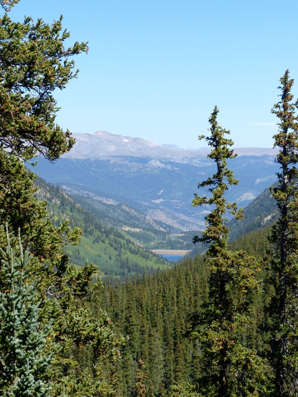
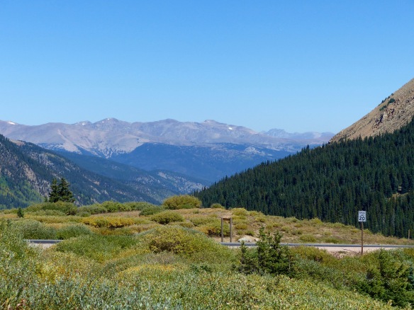
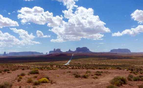
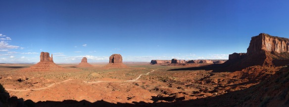
On the way to the top of the North Island

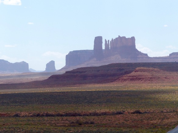
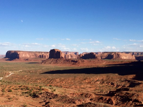
At the cape
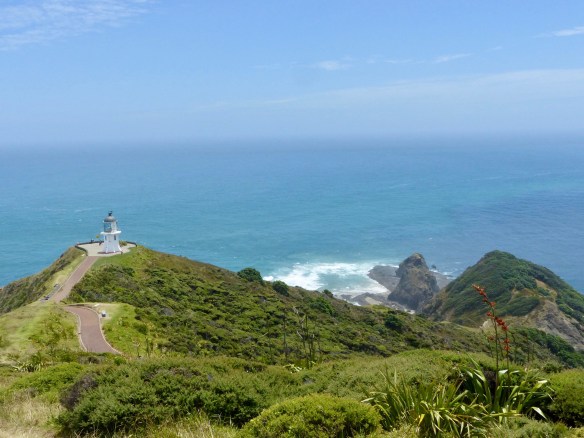
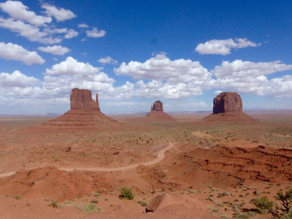
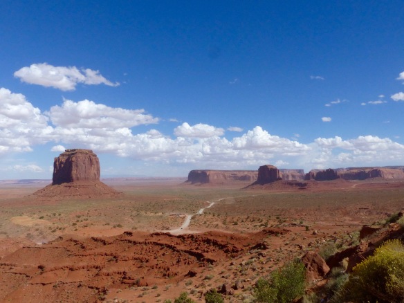
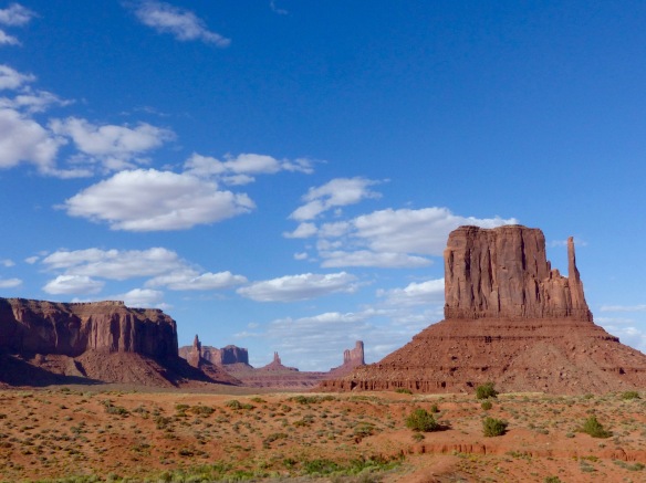
Cape Reinga
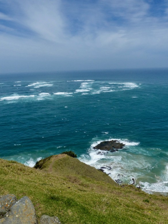
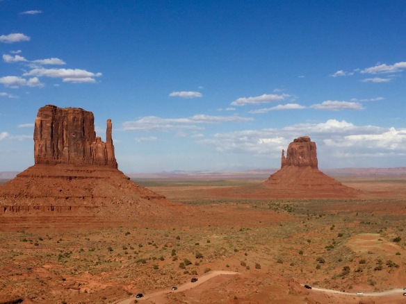
Two oceans meet!

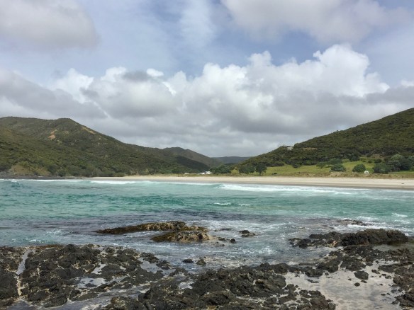
Afterwards, we made our way down the gravel road to the Tapotupotu Campground. It is a primitive campground on a lovely cove with a sand beach, and since we got there pretty early, we got our choice of sites. We spent the afternoon relaxing, exploring the beach, and observing our surroundings as others arrived at the campground. One bit of excitement involved spotting two pairs of New Zealand dotterel. They are shore birds that are endangered and not very common. After I saw them, I found some signage with information about them and warnings about not disturbing their nests. It seems we have become birders without trying to! In Russell we had purchased a book on New Zealand birds because we wanted to identify what we were seeing and hearing. And now we are constantly keeping an eye out for unusual birds. It’s been fun going through the book and checking off the birds we’ve seen. New Zealand has terrific birdlife, which often feels very exotic compared to our songbirds from the back yard at home.

Tapotupotu beach

A look back at the campground while exploring the rocks at the edge of the cove

Our frend the New Zealand dotterel


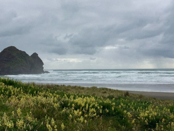
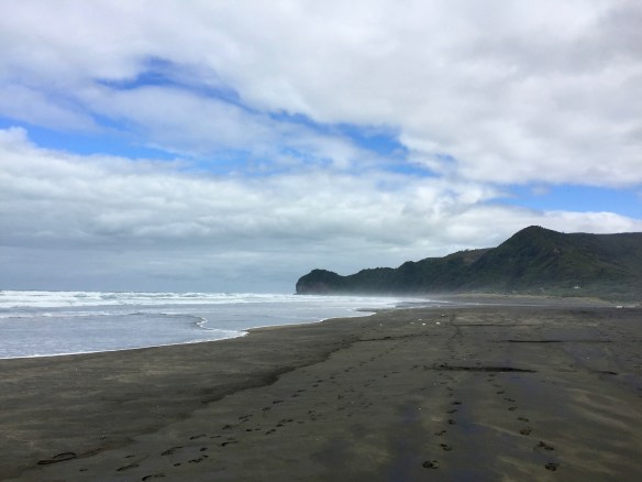
After battling quite a few pesky mosquitos in the night and having visited the northernmost point, heading south was our next agenda. We legged it the 100 Km back down the peninsula and kept going. I wanted to see the kauri forests along the west coast. So after a brief lunch stop in Ahipara, and a quick peek at 90 Mile Beach, a sixty mile stretch of sand on the western side of the peninsula where it was very windy, we kept going.
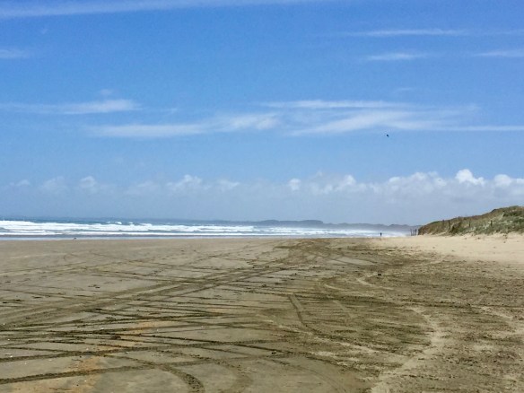
Ninety Mile Beach
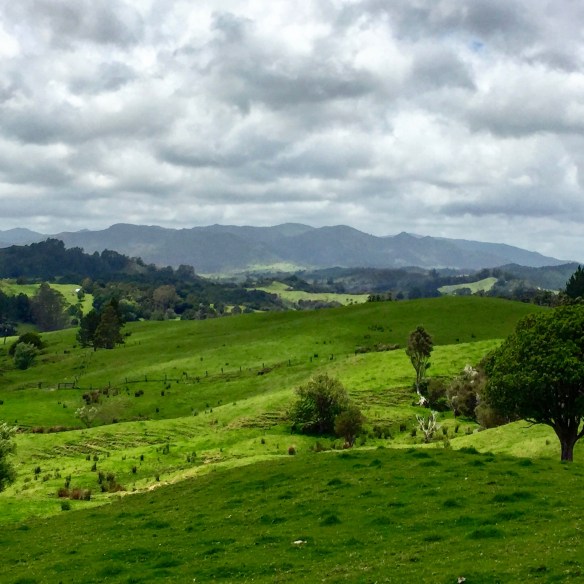
The weather was mixed, but turned more to rain as we wound our way down to Kohukohu and the car ferry over to Rawene. The landscape, however, was stunning. Everything was so green, and the undulating mountains and valleys we crossed were very lush. We arrived in time for the 2 o’clock ferry, which made a brief crossing of the Hokianga harbor.
On the car ferry


Coming into Rawene

Then we drove on to the mouth of the harbor to a blustery viewpoint. Hokianga forms a huge and winding natural harbor that stretches inland for quite a way. The entrance to the harbor is blocked by a large and treacherous sand bar which, in the old days, having wrecked a few ships, necessitated the services of pilots to guide them in. I’m not sure what they do these days, but you could see troubled waters from unknown hazards beneath and huge sand dunes across the way.
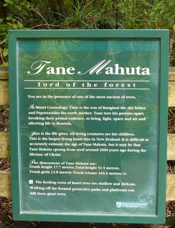
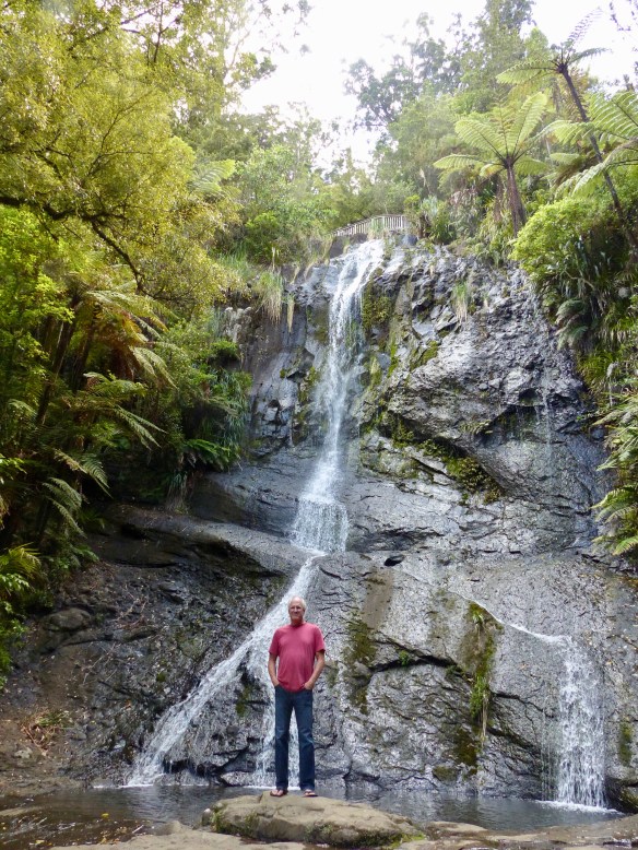
Further down the road we entered the Waipoua Forest, a large tract of forest preserved to protect the kauri trees that grow within. Kauris are native to New Zealand and forests of them once covered vast parts of the islands. Most of these forests are gone, having been logged for their superior timber, some which went to ships’ masts. Now, what is left is protected. The trees are huge and live thousands of years. They are glorious giants, akin to the giant sequoias in America. We stopped to see the largest living one left, Tane Mahuta. It is estimated at something like 2,000 years old. I would have loved to see a whole forest of these trees!
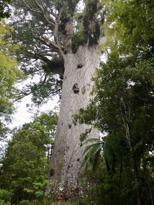
The giant!

Some perspective
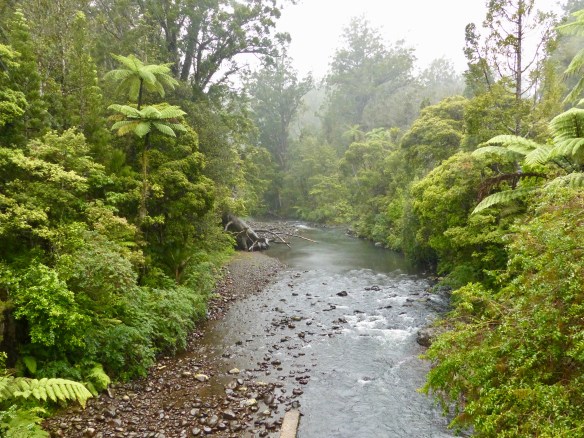
Even though it was rainy, which didn’t invite a lot of stops, traveling through the forest was magical. It was a different world of dense and completely foreign vegetation.
Those are tree ferns, not palm trees!
Late in the afternoon, we found our way to the Kauri Coast Top 10 Holiday Park. It was a really lovely spot situated in the bend of a river. The campground was well equipped with kitchen and bathing facilities and had a park like feel with lots of birds. We took advantage of the laundry machines and did some much needed washing.


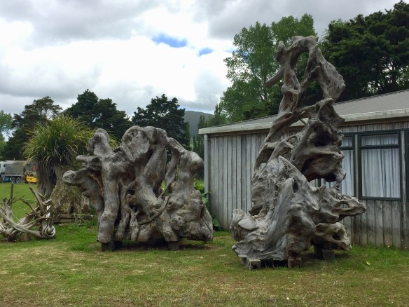
The next day we decided to drive to Piha, a beach community with the potential of surfing for Michael. Before leaving the Kauri coast, we stopped at Nelson’s Kaihu Kauri, a gallery and shop for wooden items made from ancient Kauri trees. Some 50,000 years ago, an enormous swath of Kauri trees on the west coast of the North Island were felled at the same time and in the same direction by natural disaster. Neither cyclone, nor tsunami is thought to be the cause of their demise, which remains somewhat of a mystery. Their carcasses are mined for their ancient wood and fossilized resin or gum. The wood is gorgeous, and when shaped and polished, can exude a glow from within. The gum is a bit like amber, a warm golden brown color. This showroom had a large collection of items made from this ancient wood and we succumbed to the temptation of a salad bowl. It has been shipped home for us, so we have that to look forward to later on.
Remnants of ancient kauri trees
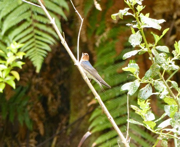
The drive to Piha was a bit long and monotonous, if that’s possible to say of the unilaterally beautiful scenery in New Zealand. Just before arriving, we stopped to hike to some waterfalls. The trail to Fairy Falls went steeply down and continued to do so with sections of stairs cut into the hillside. As we continued downward, it was hard not to dwell on the fact that, for us, what goes down must come up! When we reached them, the falls were delightful – a real oasis in the forest. We enjoyed the falls and the Welcome swallows we saw there as well. On the way back up, I counted the number of manmade steps in the trail. My count was 527!


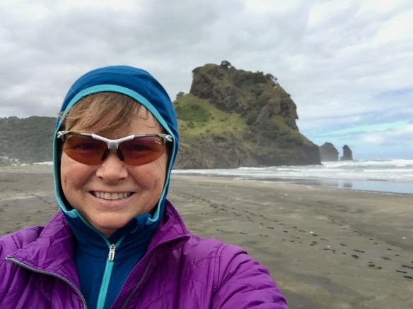
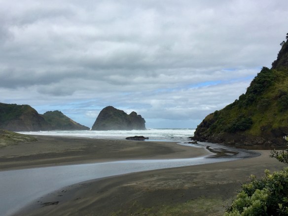
We spent two nights in Piha at the Piha Domain Camp. Piha is a popular surf spot on the Tasman Sea that is about an hour from Auckland and somewhat hard to get to, down a twisty, mountain road. It was wild and windy while we were there. The first day, the surf was quite large, but also quite unruly. Unfortunately for Michael, the conditions were not favorable for him to surf. Piha can be a dangerous place too, with rip tides and currents. There is even a “reality” television show in New Zealand called Piha Surf Rescue about the Piha Surf Life Saving Club!


Visitors to our campsite!
We thought it was beautiful, even if our time there was pretty quiet, with cloudy, windy weather, and some rain. We walked the beach, read books, and I blogged. Unfortunately, I also had a crown come loose from a tooth. So the day we left to return our campervan, I looked up some dentists and made an appointment to see one in Christchurch, our next destination.


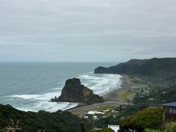
Piha from above
The drive back to Auckland did not take us very long so, with time to kill, we went back to the shopping center where we had first provisioned and did a little shopping. After checking into our motel, we returned the camper to the Britz depot and walked back to the motel. On the way, we stopped to check out a couple of restaurant options for dinner and noticed a dentist in the same strip mall. Thinking I had little chance of success, I popped in to see if they could fix my tooth. It was about 4:30 p.m. by this time. Lo and behold, they could see me in twenty minutes! I couldn’t believe my luck! Michael went back to our room and I waited for the dentist, who was a woman and very capable. In no time, she had my crown re-cemented and I was on my way. It wasn’t cheap, but I got what I needed. I was happy to have that accomplished and to call and cancel the appointment scheduled for after our flight to Christchurch the next day.

At the Kiwi Airport Motel
We enjoyed our camper adventure, though I don’t think I’d want to spend three months in one. It was fun to stay in some really beautiful spots we probably wouldn’t have seen otherwise. For anyone considering a tour by campervan in New Zealand, here is my advice.
- Go with the smallest vehicle you think you can be comfortable in. The roads are small and larger vehicles are just more cumbersome.
- You will find New Zealand is VERY well equipped to cater to your needs. All the services you need for camping and campervans are readily available, almost everywhere, from campgrounds and dump stations to grocery stores and petrol or diesel to hot showers and cooking facilities.
- Don’t bring a lot of stuff. There isn’t much storage in a campervan and the smaller the vehicle, the less there is.
- Don’t plan on going very far in any one day. It takes longer than you think and driving around in the camper is not the best part of the journey, the stops are.
- Driving on the left is not that hard. You get used to it. Just be sure to look right first when pulling out!
Our adventures in New Zealand continued on the South Island, but that will be the subject of a different post.
Until then, see you down the road!